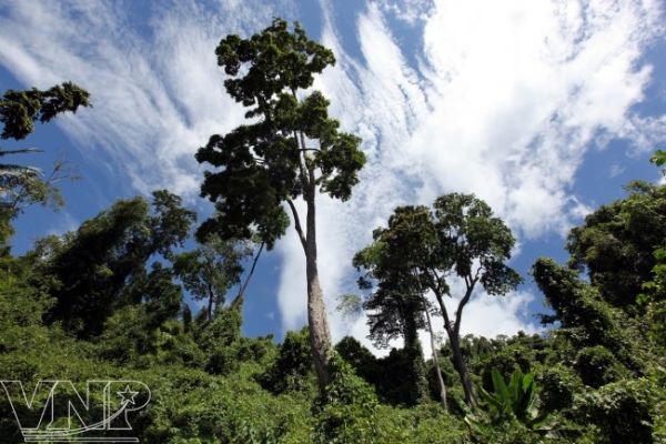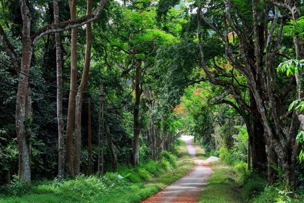

Among the meandering mountain passes of the northwest, the four greatest are Pha Din, O Quy Ho, Khau Pha and Ma Pi Leng.
The Pha Din pass
The Pha Din pass is 32km long on Highway 6 and part of it belongs to Phong Lai commune, Thuan Chau district, Son La province, while the rest is in Toa Tinh commune, Tuan Giao district, Dien Bien province. The name of the pass is derived from the Thai ethnic minority language in which Pha means the Sky and Din means the Earth. Pha Din is the place where the Earth meets the Sky.

The elders in Lai Chau (the part now belonging to Dien Bien) and Son La recount that the two localities were divided in a horse race between the two opposite sides of Pha Din mountain pass. The place where two riders and their horses met would be considered the boundary between the two localities. As Lai Chau’s horses galloped faster, the Lai Chau’s part of the Pha Din mountain pass is a bit longer than that of Son La.
The peak of Pha Din pass is 1,648m above sea level on arduous terrain, with mountain walls in one side and abysses in other side. This zigzag pass includes continuous ascents and descents with 8 very dangerous sharp curves of less than 15m radius and various blind, sharp and A or Z- shaped curves. Some curves are narrow, with room for only one car; thus, it would be very dangerous if another vehicle comes at a blind corner.
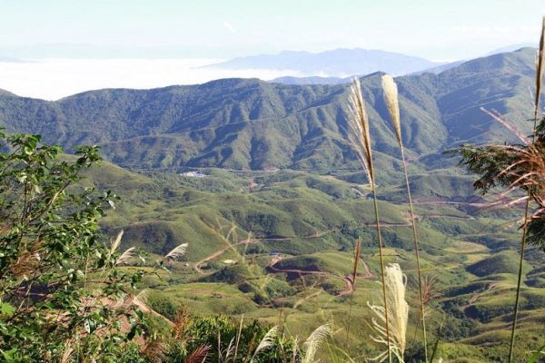
The Pha Din pass is always covered by clouds and at its foot there lie villages of ethnic minority groups. Looking down from the uphill part belonging to Dien Bien province, one can see Muong Quai Valley stretching in a large area of immense green mountains and hills interspersed with several villages of Tuan Giao district. Standing at the peak, one could see only the blue sky, none of the villages are in view. The blue sky and grand mountains seem to be locked to each other.
In Vietnam’s resistance war against the French invaders, the Pha Din mountain pass was one of important arterial roads to transfer munitions and food to the front in the Dien Bien Phu campaign (1954). In order to cut this route, the French General Christian de Castries decided to bombard Highway 6 of which the Pha Din mountain pass, and Coi Noi fork (the present national historical relic site in Mai Son district, Son La province) suffered the most losses. 8,000 young volunteers sacrificed their lives to protect this arterial road, turning Pha Din into a symbol of brave and tough spirit. At present, a stele stands to mark this historical event on the top of the Pha Din mountain pass.
The O Quy Ho mountain pass
The O Quy Ho mountain pass, also called Hoang Lien Son or May (Clouds) mountain pass, is located on Highway 4D, cutting across the Hoang Lien Son mountain range. The O Quy Ho mountain pass connects Lao Cai and Lai Chau with the boundary on the top of the mountain pass.

Legend has it that in the old time there lived a kind of bird whose song sounded like the words “o quy ho”. It was said that this sound reflected the unsuccessful love affair of a young couple. Over time, the pass was named after the bird’s singing “o quy ho”. The deserted mountain pass is about 2,000 meters above sea level.
This 50km long O Quy Ho mountain pass is the longest pass in the northwestern Vietnam. Due to its height, length, arduous terrain and meandering curves, O Quy Ho is dubbed “the King of the northwest mountain passes”. The top of the O Quy Ho mountain pass, always embraced with thick white clouds, is also called the gate to the heaven. In cold winter, this place is sometimes covered with ice and snow.
In the past, few people dared to cross O Quy Ho Pass due to the frightening stories about people caught by tigers in the area. At present, though the pass has been upgraded and busy with vehicles, standing mountain walls and abysses on either side of the pass still make it a difficult driving challenge.
The Khau Pha mountain pass
With the length of over 30km, the Khau Pha mountain pass is the longest and the most dangerous pass along Highway 32. Located between the two districts of Van Chan and Mu Cang Chai of Yen Bai province, Khau Pha with the height from 1,200 to 1,500m above sea level, traverses a number of famous landmarks like La Pan Tan, Mu Cang Chai, Tu Le, Che Cu Nha and Nam Co.

Because the pass is always covered with thick fog, and its peak seems to rise sheer from the clouds, Khau Pha in the Thai ethnic minority language means the Sky Horn (a horn rising up to the sky) or the Heaven Gate. Meanwhile, the H’Mong ethnic people consider Khau Pha a place of supernatural power where God can hear human pleas. Thus, the H’Mong people often come to Khau Pha to pray whenever they have some problems in lives or lose their crops.
The Khau Pha mountain pass curves round ancient forests and terraced fields cultivated by the H’Mong and Thai ethnic people. About two thirds of the pass is gravelled, rough and bumpy. Stiff slopes and dozens of sharp and blind curves along the pass without any barriers or warning signboards make driving very difficult and dangerous. Located in an area of basaltic soils with weak ground, the degraded Khau Pha mountain pass could easily be destroyed by subsidence and landslide. Worse still, rocks from high mountains might fall down at any time.
Regardless of these dangers, Khau Pha is still a destination for a large number of adventurous travellers, especially in September and November when yellow terraced fields are in harvest season.
The Ma Pi Leng mountain pass
With the length of 20km, the arduous Ma Pi Leng mountain pass, traversing the Ma Pi Leng mountain peak of 2,000m high in Dong Van plateau, is part of the Happy Road connecting Ha Giang city, Dong Van and Meo Vac towns.

The mountain pass was built by tens of thousands of young volunteers from 16 ethnic minorities in 8 southern provinces in 6 years (1959-1965). Especially, a heroic squad had to climb onto cliff walls to cut into the mountain little by little over 11 months to make the road passing the Ma Pi Leng mountain peak.
Ma Pi Leng in Mandarin language means “horse nose” because the sheer mountain peak is compared to a horse’s nose by the local people. Figuratively, the name means that the pass is too dangerous to climb even for horses. They might be exhausted climbing there, especially the pregnant ones.
Before the 1960s, over 80 thousand H’Mong (Meo) ethnic people living in the four districts behind the mountain grandeur of the Dong Van plateau had no concept of “road”. For many generations, the only way to pass Ma Pi Leng was to pile wattles on rocks to hang ropes and cling on these ropes to creep over nine rounds of craggy mountain slope path full of rugged rocks. The 9-round slope path to the Ma Pi Leng mountain peak is also called the Slope of God.
In order to help ethnic groups in mountainous areas to catch up with the civilized life in the plain, the Central Committee of the then Labour Party of Vietnam and the then Viet Bac Regional Party Committee decided to open the road to connect Ha Giang – Dong Van – Meo Vac, which is later called the Happy Road.
Though the Ma Pi Leng mountain pass, a part of the Happy Road, is not very long, it is the most arduous pass in the mountainous areas of the northern border. It is even dubbed “the King of Vietnam’s mountain passes”. At the beginning, the pass was only wide enough for pedestrians and horse-drawn carts. Later, it was widened so that cars and vans can go by. However, it is still very difficult and dangerous for two cars to avoid each other because of blind and sharp curves, and rough road.
The construction of the Ma Pi Leng mountain pass, including the 9-round slope, is really a miracle. Some even compare it to the Great Wall of China or a Pyramid. On the top of Ma Pi Leng, the highest point of the Happy Road, there is a stone stele with information on the construction of the Ma Pi Leng mountain pass, and also a place for people to enjoy a good view of this mountainous region.
Source: Dulichvn