NINH THUAN PROVINCE
Square: 3,363.1 km2.
Population: 570,100 people (2010)
City: Phan Rang - Thap Cham City
Districts: Ninh Hai, Ninh Phuoc, Ninh Son, Bac Ai, Thuan Bac.
OVERVIEW
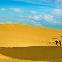
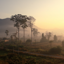
Ninh Thuan province is lying in the middle of Central Viet Nam, has a small plain created by the Dinh River originating from Lam Vien Plateau. The province is famous for white-sand beaches, vast gardens of table grapes, onions and hot peppers. The province is also inhabited by a great number of the Cham ethnic minority people.

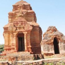
Cham tower - Ninh Thuan Province
HISTORY
The Cham principality of Panduranga had its center in Ninh Thuan Province, but also included much of what is now Binh Thuan Province. Panduranga became the political centre of Champa after the fall of Vijaya in 1471. It remained independent until 1832, when emperor Minh Mang annexed it.
Ninh Thuan was merged into Binh Thuan Province in 1976, together with Binh Tuy Province. Ninh Thuan became a separate province again in 1991.
GEOGRAPHY
Located in South-Central Coast, Ninh Thuan shares border with Khanh Hoa Province on the north, Lam Dong Province on the west, Binh Thuan Province on the south and East Sea on the east.
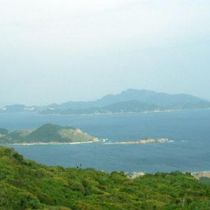
The terrain is a mixture of mountain, plain and seaside. Main rivers name Sat, Cai, Ong, Gia, Can, La, Quao. Mountains surround three faces of Ninh Thuan including Tha Nhonh, Chuan, Suong Mu, and Hon Dien mountains. Long seaside makes Da Vach, Thi, Ca Na capes and sea ports.
CLIMATE
The climate is a combination of the tropical monsoon and dry and windy weather. It is hot, dry, windy all of year. There is two seasons: the rain season lasts from May to November, the dry season lasts from December to April. Annual average temperature is 27ºC.
TOURISM
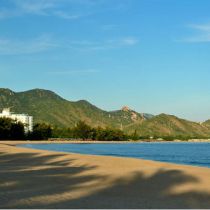
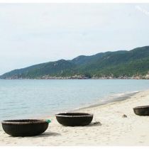
Ninh Thuan belongs to tourism triangles: Da Lat - Nha Trang - Phan Rang. Coming to there, tourists are able to relax in Ca Na Tourist Site, swim in Ninh Chu Beach, Vinh Hy Bay, climb to Da Trang Mountain, and observe natural animals in Phan Rang Reservation, or visit Pi Nang Tac Stone Trap.
Being home of Cham minority group, Ninh Thuan has characters culture of Cham ethnic, which stamp in local custom, Cham dance, sculpture, pottery, and brocade and agriculture of Cham towers. Famous towers name Po Klong Garai and Porome.
Nowadays, Cham people still preserve matriarchy, a valuable inheritance of Vietnam, and special festivals such as Kate, Cha Bun ceremonies, Royal Idiladha and Ra Glai Tribe festivals and other ceremonies like dig a ditch, dam up, new rice.
TRANSPORT
Phan Rang - Thap Cham City is 105km from Nha Trang, 110km from Da Lat, 350km from Ho Chi Minh City and 1.382km from Hanoi. Phan Rang Town is on North - South Express Train, National Highway No.1A and National Highway No.27.