LAO CAI PROVINCE
Square: 6,383.9 km2.
Population: 626,2 thousands people (2010)
City: Lao Cai City.
Districts: Muong Khuong, Bat Xat, Bac Ha, Bao Thang, Sapa, Bao Yen, Van Ban, Si Ma Cai.
OVERVIEW
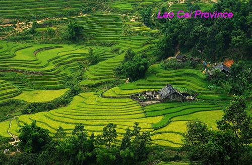
Lao Cai is one of several provinces situated on the Sino-Vietnamese border. Topography of Lao Cai is diversified with rivers, high mountain peaks, steep and high mountain passes, deep streams and wide valleys.
Terraced fields - Lao Cai Province
HISTORY
Lao Cai has been known since ancient times as a historic trading post. Here, the Chinese, the Vietnamese and the ethnic minorities of the region fought to gain control of the region. In 1463, the Viet Kings established Lao Cai as the capital of their northern most region, then named as Hung Hoa. It came under French colonial rule in 1889 and was their administrative town, and also served as a military garrison. In the early 19th century the first railway line was built from Hanoi to this region. It took 7 years to complete but at the cost of 25,000 lives of Vietnamese conscripted labour.
In late 1978, the Vietnamese invaded Cambodia. In retaliation, the Chinese, as allies of Cambodia, countered and invaded North Vietnam with the sole aim of “teaching the Vietnamese a lesson”. The attack was launched by 60,000 strong Chinese Army from several fronts. They occupied territory from Paso (previously known as Phon Tho) in the Northwest to Cao Bang and Lang Son in the Northeast. The Chinese were ill prepared for such a massive campaign, and within two weeks their attack crumbled, they lost 20,000 troops and withdrew from Vietnam but still boasting that they had won the battle. The Vietnamese had won a decisive battle on all fronts. It has been inferred that the border town, 295 km from Hanoi, with good rail, road and river traffic provided the impetus to the invaders to threaten Hanoi and the Red River Valley and that the "attacks here were intended as distractions to prevent their Vietnamese defenders from moving to reinforce the defense of Lao Cai.
GEOGRAPHY
Located in North-West Vietnam, Lao Cai is surrounded by Yunna (China) on the north, Lai Chau Province on the west, Ha Giang Province on the east and Yen Bai, Son La provinces on the south.
Lao Cai's terrain is divided into main kinds following: valley, low and high mountainous. With 3,143m in height, Fansipan is considered the highest peak of the Indochina Peninsula. The province has 107 rivers including Red, Chay and Nam Mu rivers... The province also owns 31 types of mineral, of which apatit, cooper, iron are most valuable.
The remarkable feature of Lao Cai is biologic diversification. There are 2,000 kinds of flora, 442 kinds of birds and animals... of which 60 kinds of animals only found in Lao Cai, 9 kinds of floras only found in Sapa. So that Lao Cai owns a treasure of valuable and rare genes, making up 50% rare floras in Vietnam.
CLIMATE
Lao Cai has typical mountainous climate. The dry season lasts from October to March, it is cold. And the rain season is from April to September. Annual average temperature is 23ºC. Specially, sometime, there is snow in Sapa.
TOURISM
Lao Cai preserves lots of special cultural and historical sites. Outstanding vestiges is ancient stone engrave area with picture of map, handwriting, people thousand years ago in Muong Hoa Valley (Sapa), Pho Rang vestige. There are many beautiful caves like Thuy Tien (Bat Xat), Ta Phoi (Cam Duong), Tien-Trung Do (Bac Ha), Xuan Quang (Bao Thang).
Lao Cai is very proud of Sapa, a unique natural tourist site. Many new married couples like spending their honeymoon in Sapa because of good weather and romantic sightseeing. Visitors to Sapa in summer can feel the climate of four seasons in one day. They enjoy discovering other interesting places including Ham Rong Mountain, Silver Waterfall, Rattan Bridge, Bamboo forest, Ta Phin Cave and Sapa ancient rock field. Taken place every Saturday night, Sapa Market is an attractive place for visitors who are keen on exploring traditional cultures.
In addition, Bac Ha Market hosts the biggest fair near the mountainous highlands. It is a typical weekly activity for the H'Mong and other minority groups living in the locality. In Cat Cat Village many H'Mong residents are good at manipulating gold and silver jewelry.
It is festinate to travel from Lai Chau to Lao Cai following National Highway No. 4D because of scenery along roadsides and impressive sight of Hoang Lien Son Range. This way attracts to people liking the adventure and discover on bicycle, too.
TRANSPORT
Located 300km from Hanoi, Lao Cai can be reached by car or train. There is National Highway No.70, 279, 4D linking Lao Cai to Yen Bai, Lai Chau and Ha Giang, China in turn. There are some trains depart from Hanoi daily to Lao Cai.
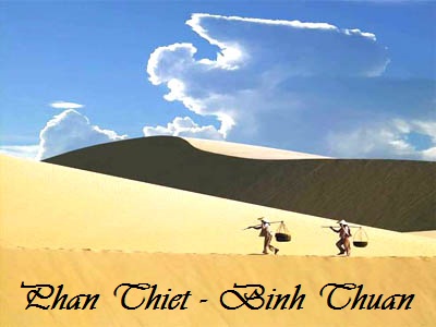
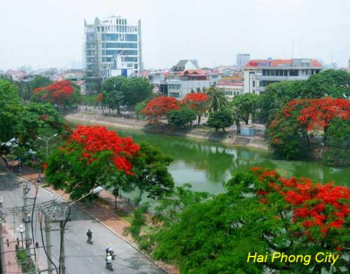
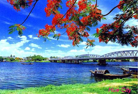
You are pleasure choice a city!
62 hotels
48 hotels
1 hotels
2 hotels
11 hotels

5 hotels
11 hotels
24 hotels
1 hotels
1 hotels
1 hotels
17 hotels
2 hotels

3 hotels